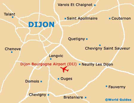
Dijon Bourgogne Airport (DIJ)
City Orientation and Maps
(Dijon, France)
Located in the Burgundy area of France, the city of Dijon stands in eastern central France. The city itself is fairly small and full of charm, with the centre being easily walkable. Dijon is well connected to the rest of France, with the Gare Routière and Gare SNCF train stations on the western side of the city, and the Dijon Bourgogne Airport (DIJ) on the south-eastern outskirts, in the Longvic area.
From the train stations, the Maréchal-Foch Avenue leads you to the Place Darcy, where you will find gardens and the main tourist information centre. Be sure to look out for the 'Cote d'Or en Poche' booklet, which provides up-to-date listings of things to do in the Dijon area. The tourist information centre also sells the popular 'Dijon Card', which provides free access to a number of museums and public transport. The card also allows you guided tours of the city free of charge.
Dijon Bourgogne Airport (DIJ) Maps: Important City Districts
Within the heart of the city, the Rue de la Liberté forms the main artery and stretches east, from the Place Darcy. Along the way, the road passes the Place de la Libértation, an elegant semi-circular public space, located alongside the famous and eye-catching Palais des Ducs. From here, the Rue Rameau leads further east, towards the Place du Théàtre, close to the historic St. Michel church.
France Map

Dijon Map